UNESCO San'in Kaigan Global Geopark
The Tango Coast
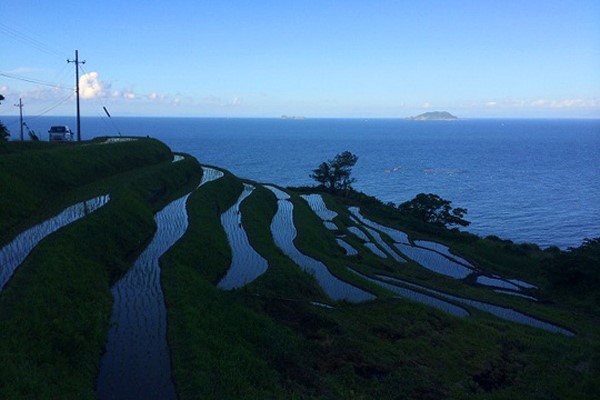
The San’in Kaigan Geopark runs through the prefectures of Kyoto, Hyogo, and Tottori. The Kyoto portion of the geopark is in Kyotango. It has a coastline shaped by volcanic activity and the Japanese Sea. Traveling the coast from Ine Bay, home to the Japan Heritage funaya (boat houses), you will first encounter the Sodeshi rice terraces. These active rice paddies are sandwiched between the mountains and the sea, and offer incredible vantages of rural Japanese life on the sea. In the spring the rice fields are flooded and they reflect the sky in their still pools, giving the viewer a feeling of incredible expansiveness. When it comes time to plant and harvest the rice paddies, Sodeshi offers visitors a chance to partake. As many of these paddies are uniquely shaped and planted/harvested by hand, visitors are given a special glimpse into the people keeping rural agriculture alive in Japan.
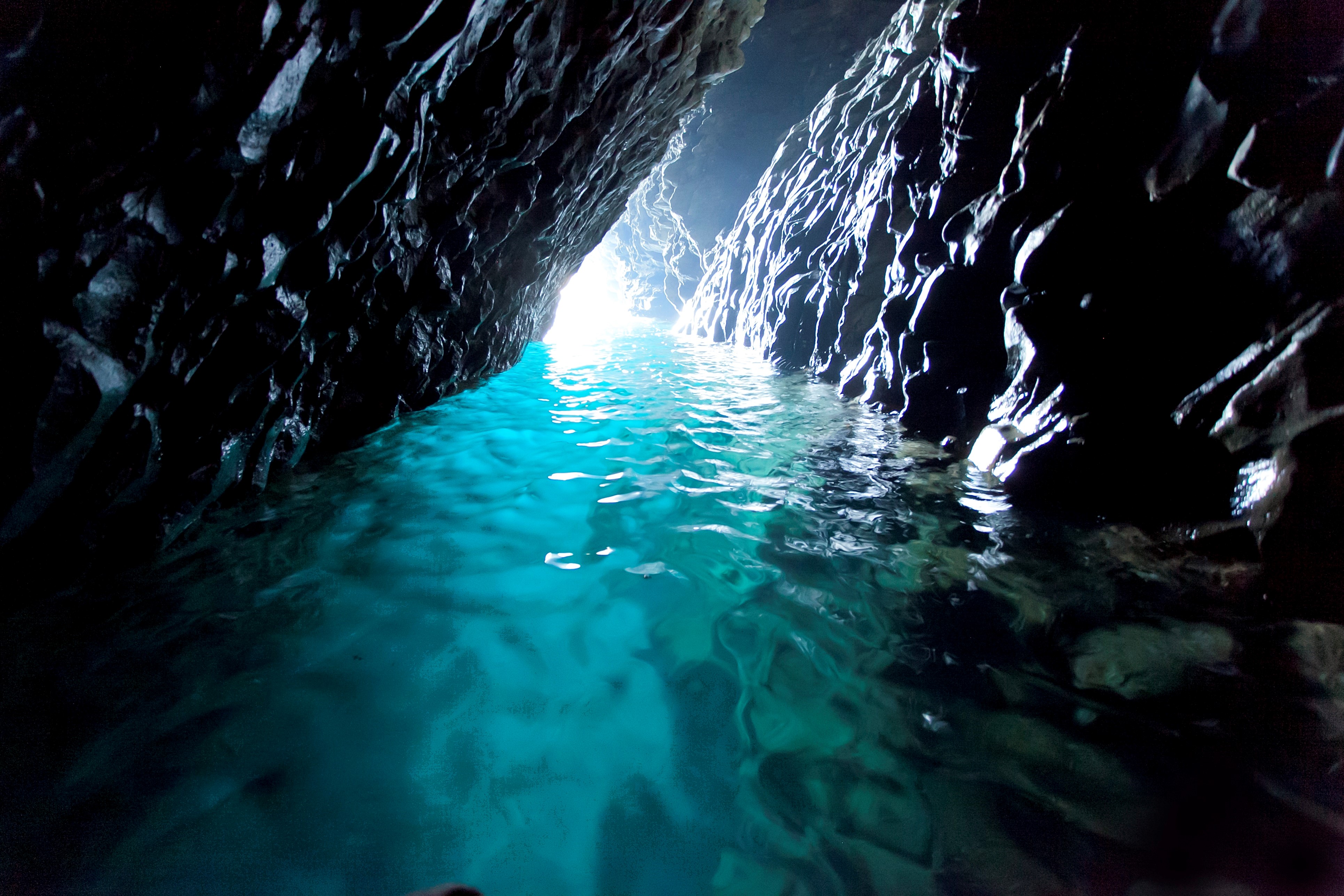
Following the coastline, you will pass Ukawa Onsen up on the hill overlooking the sea. This location features natural hot springs in an architecturally beautiful building. The facility includes two restaurants as well as accommodations. Nearby are a few stretches of sandy beaches replete with rock formations and caves. The beaches are popular with surfers when conditions are good.
Continuing along the coast towards Hyogo prefecture you will pass Tango Matsushima, a series of small pine islands on the Japanese Sea distinctly reminiscent of Matsushima in Sendai, one of Japan’s Three Scenic Views. There is a parking area on the left and an overlook for pictures.
Next, you will enter the fishing village of Taiza, home to the delicacy, Taiza crab. This village has a variety of coastal sites, including a series of burial mounds on a hill overlooking the sea dating back to the 6th century. The grounds have a staircase that takes one down to a beach where rare basalt columns rise out of the sea. This area features some of the most unique basalt formations in Japan, none more iconic than Tateiwa, a giant boulder standing at the mouth of the Takeno River where it meets the Japanese Sea. There is a wide footbridge that crosses the river, affording the viewer an excellent, head-on perspective of Tateiwa.
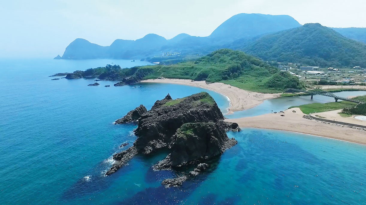
The next town along the Tango Coast features a beach with sands that sing due to their unusually high quartz content. The beach is called Kotohikihama (located in the town of Amino), and along with its crystal-clear waters, pine forest hiking paths, excellent surf, and singing sands, there is a proximal Singing Sands Museum for those wishing to learn the secrets of the sands.
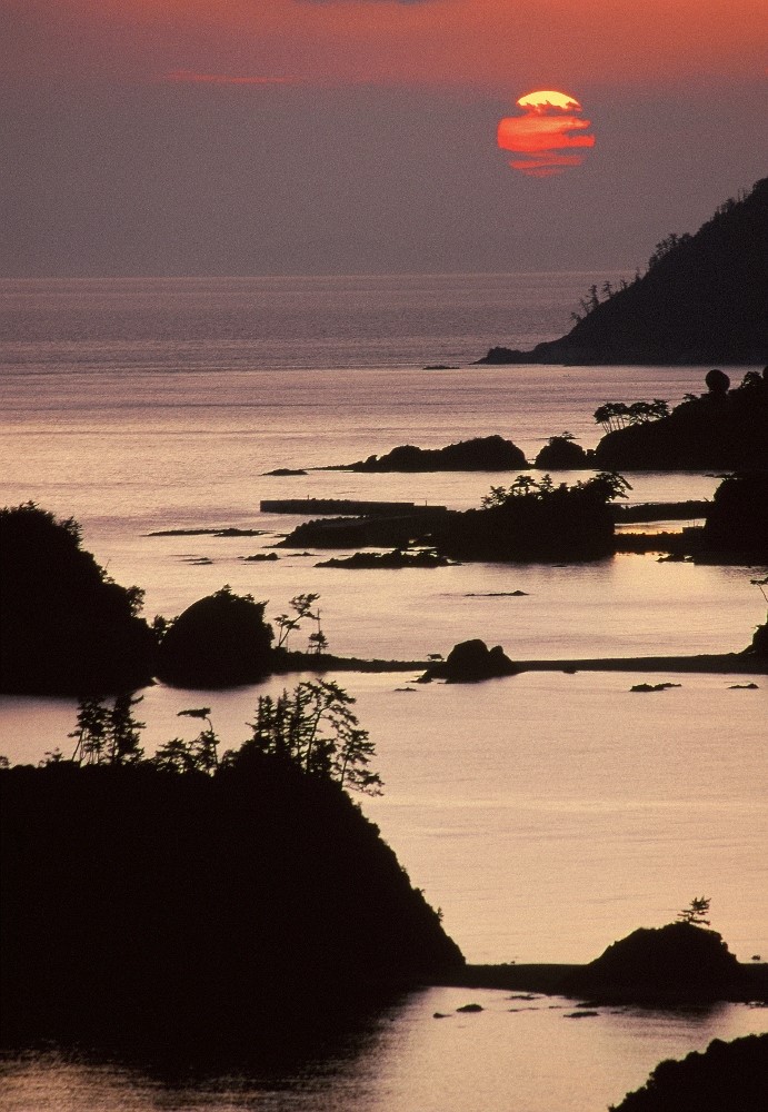
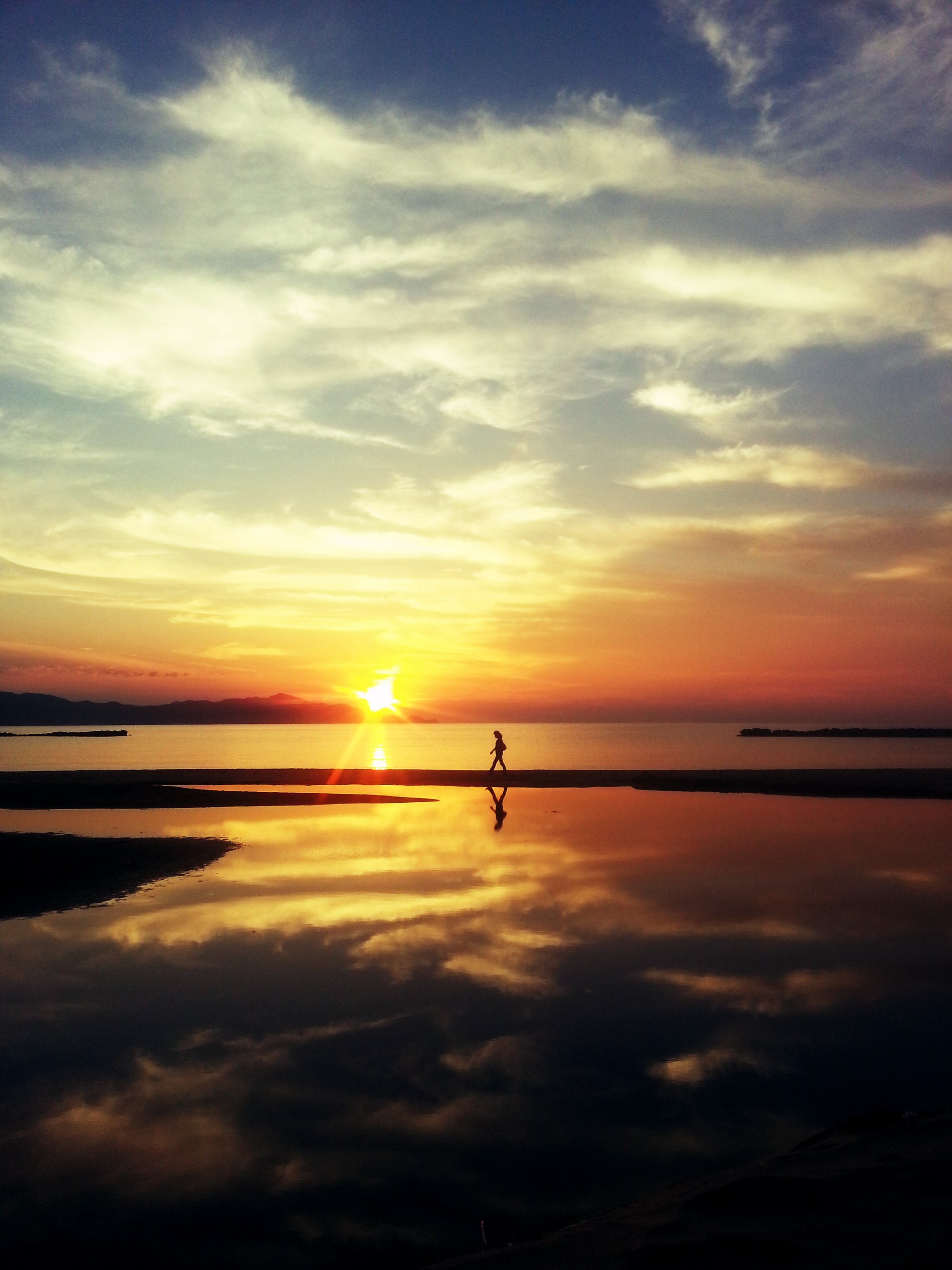
The coastline features a variety of natural hot spring locations, one of the most stunning being Yuhigaura, a hot spring resort area known for its deep, colorful sunsets. Walk along the beachside paths or take a rest on the classic driftwood swing on the beach.
The last stop along the Tango Coast, before arriving in Hyogo Prefecture, is Kumihama, a town with a large bay separated from the Sea of Japan by a narrow stretch of land. The area has temples on the bay, as well as Japanese inns, art museums, sake breweries and hot springs.
The Tango Coast is most accessible when driven, but buses run the entire length of the coastal roads. Trains will also make stops in Kumihama, Yuhigaura, and Amino.